QR Code Heritage Trails
FÁILTE TO THE PARISH OF KILLIMER FROM THE LOCAL HISTORY GROUP
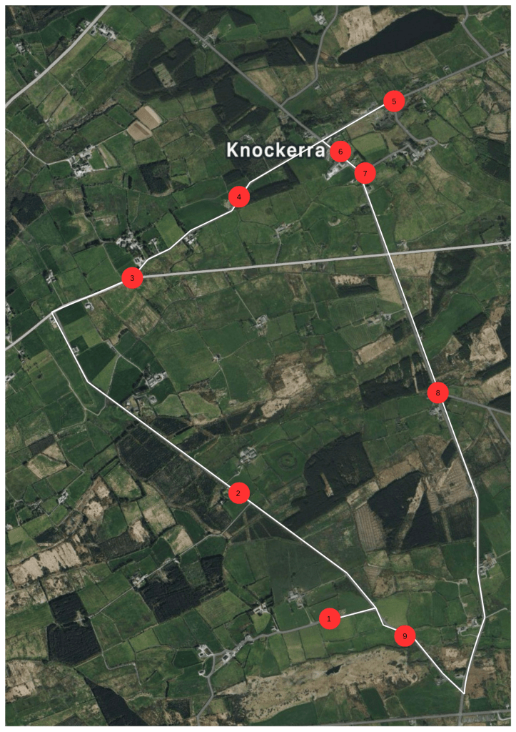
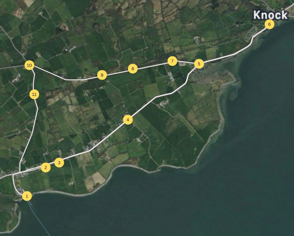
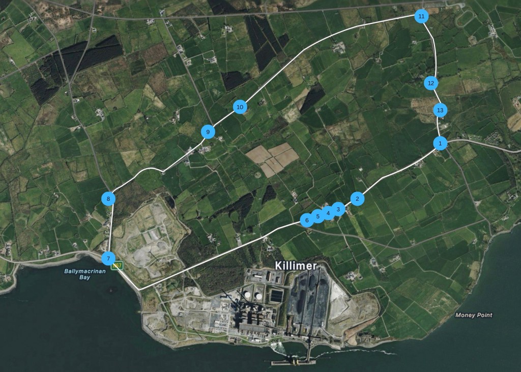
Our QR code heritage trails will guide you to selected heritage and local landmarks in this parish. There are three separate trails for you to explore, some are ideal for walks and cycles while others are better to explore from your car. Various historical locations will be brought to life through narrated history, pictures anecdotes and digital interpretation. You can explore these trails virtually though our website here or explore the trail in real life by following the maps below and scanning the QR codes at each destination. Our QR codes will be on the roadside closest to the landmark. We would like to thank all who made this venture possible as it was no mean feat to take on. To all the locals who gave permission for these QR codes to be put in place and for the drone footage to be taken, to those who shared information, pictures and recordings and a special thanks to Pat McMahon who spent hours gathering our drone footage.
We would like to stress that many of the sites are on private property and it would be necessary to get permission to visit the specific sites from the owner.
Disclaimer: The majority of the information with our heritage trail is from our two publications where all sources were referenced all other information is local knowledge and folklore. The majority of the maps come from the geohive and Clare County Library historical map websites.
The Burrane Triangle
The Trail of Tears
In the Footsteps of Saints