Maps of the Parish
Like all place-names, the spelling of Killimer, and its townlands, has evolved over many years due to them being recorded in an anglicised fashion and also through different translations and interpretations of the Irish language. This is visible in the following maps through the ages.
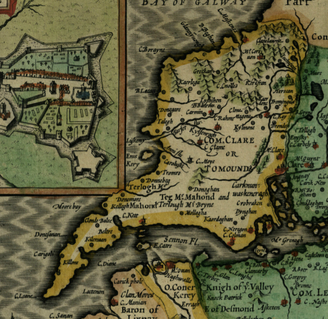
Map of Thomond by John Sudbury and George Humble – 1610.[1
You can see Mollogha clearly written under those in charge at the time– Teg McMahond and Terlough McBryne
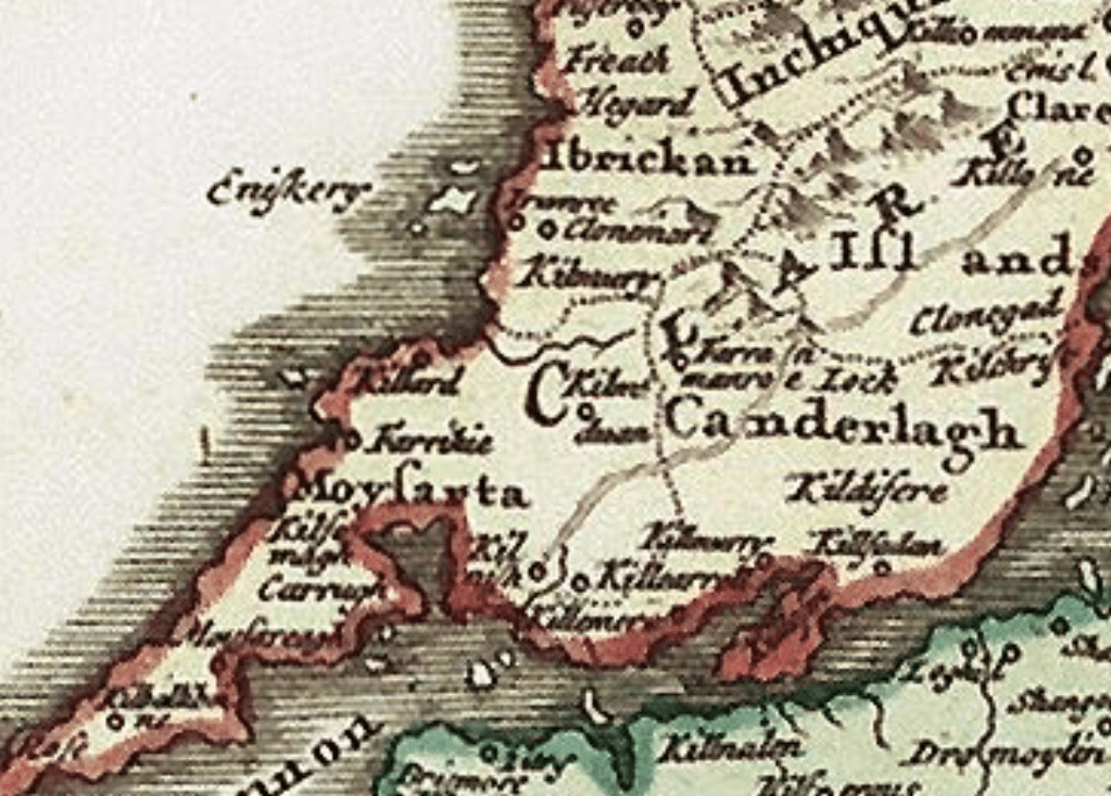
Hibernia Regnum c. 1650.
In this better proportioned map we can see Killoner and Killcarrell

Sidney Hall 1830
A slightly stranger perspective of Clare, here we can see Ballymacron, Kilmore and Burnaan. You can also clearly see Gower just at the North end of the Parish
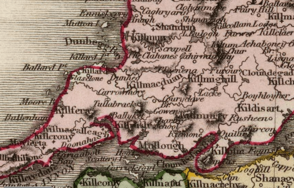
John Pinkerton 1813
In this map we can see Mullough for Molougha, Kilmone and a Charter school
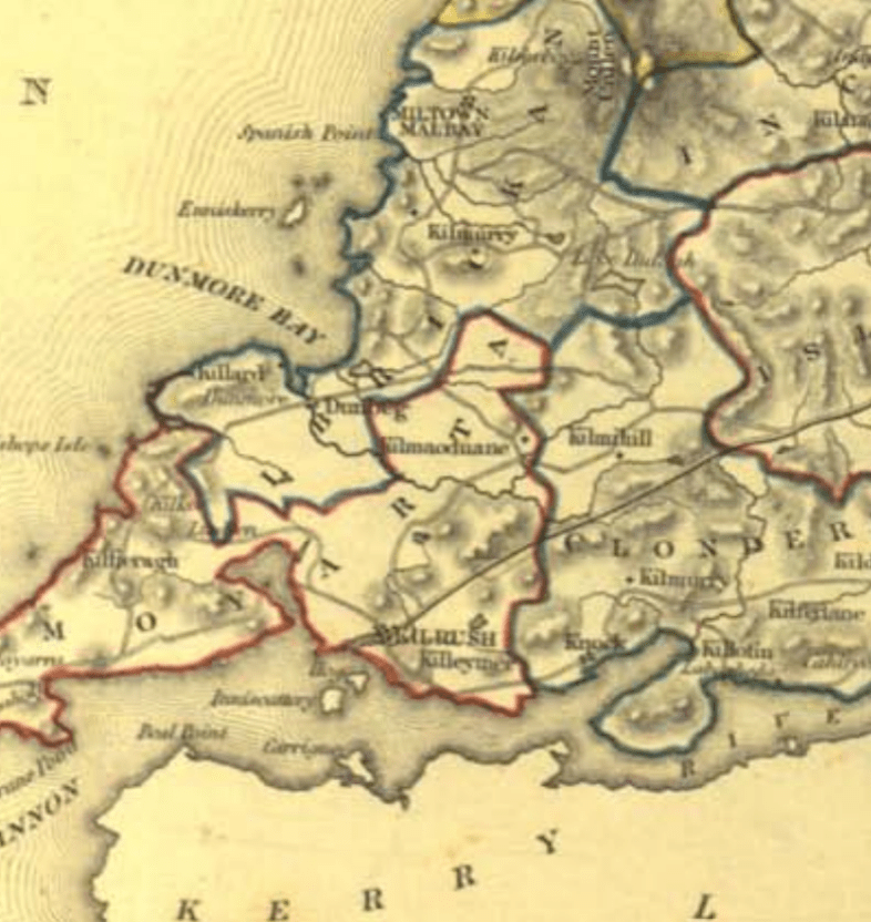
Left: Samual Lewis 1850
This map, while a bit blurrier than the others, shows clearly the divide between the Baronies of Moyarta and Clonderlaw.
Killeymer is also marked as well as Knock
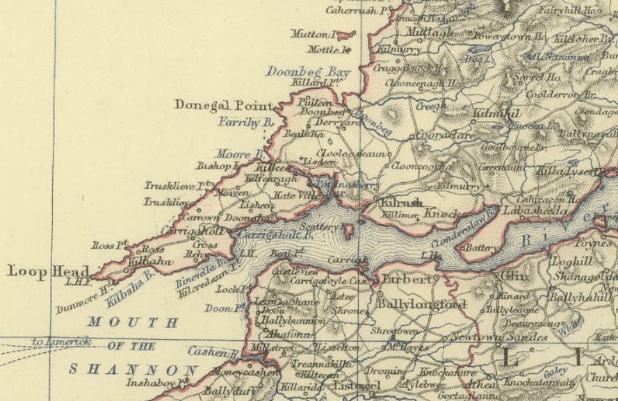
Alexander Johnston 1879
This map has Killimer church clearly marked on it.
These are but a few of the maps available. For those of you who love exploring maps here are some links that you can enjoy exploring to your hearts content.
This is an interactive map from the 1800’s you can manipulate
https://www.loc.gov/resource/g5780.ct000414/?r=0.034,0.729,0.496,0.24,0
This is a collection of maps that cover Clare over many years. There are many tools you can use to manipulate the maps
https://www.clarelibrary.ie/eolas/coclare/maps/index.htm
These are all the past OSI maps. You can flick through the different layers.
https://osi.maps.arcgis.com/apps/webappviewer/index.html?id=bc56a1cf08844a2aa2609aa92e89497e
This is a fascinating interactive tool that lets you explore the CSO figures in your area.
https://www.cso.ie/en/interactivezone/visualisationtools/censusmappingresources
Over 100,000 maps from around the world to explore!
